Human-elephant conflict was highlighted as one of the major threats to elephants in Kenya in the ‘Kenya Wildlife Service (KWS) Conservation and Management Strategy for Elephant in Kenya 2012-2021′. It was this document that inspired Lydia to develop a PhD project to try and understand the impacts of land-use change on human-elephant conflict and elephant movement in the Trans Mara District, Kenya. Lydia specifically wanted to:
- Determine the implications of agricultural expansion on human-elephant conflict;
- Understand the seasonal, temporal and spatial drivers of crop raiding over time;
- Investigate elephant pathway use and their role in human-elephant conflict;
- Understand links between farmer poverty and human-elephant conflict.
Lydia chose the Trans Mara District to carry out her research as it is an unprotected area adjacent to the Masai Mara National Reserve where communities are experiencing high levels of human-elephant conflict, which is impacting peoples livelihoods and threatening elephant populations.
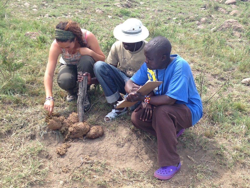
In 2014, Lydia headed out to the Trans Mara to start collecting data. In order to look at seasonal, temporal and spatial trends of elephant crop raiding and compare these to the past, she had to monitor and collect incidences of conflicts over 18 months. Lydia hired and trained 12 field scouts from across the region, which was approximately 2,900 km2, to help her collect data. Lydia tells us more below:
“Whenever there was an incident with an elephant our scouts would go and collect this data. As the scouts were embedded members of the community, farmers would alert them straight away to incidents. The scouts would then interview the farmers about the incident, verify the amount of damage, collect a GPS coordinate and work out the type of elephant group involved.
“My research also focussed on elephant movements in the area and so I looked at natural pathways that elephants use to travel up from the Masai Mara Reserve into the Trans Mara and back down again. The first step was to actually identify where the pathways were which we did by consulting with local farmers and rangers and verifying them by physically visiting them and looking for elephant signs. In order to understand pathway usage we installed over 38 camera traps along the pathways. Our goal was to determine when, how often and what time of day elephants are using the pathways, and what characteristics of these pathways might be driving their movement.”
Another aspect of human-wildlife conflict that Lydia wanted to investigate was the link between wealth and the number of conflicts being recorded in the region. The research team conducted a total of 326 interviews with farmers and four focus group sessions to determine what the wealth metric of the area was.
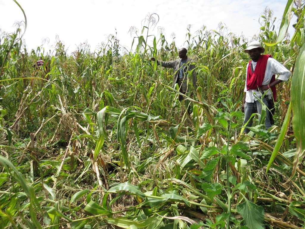
Lydia also digitised land cover in the area and ran regression models to create maps of areas particularly vulnerable to crop raiding, allowing her to generate different land-use change scenarios. Firstly, she documented dramatic land-cover change in the area showing that between 2012 and 2015 there was a 42.5% increase in agricultural land and over 30% decline in forest area. Lydia continues:
“These trends are concerning because the forest in the Trans Mara is extremely important not just for wildlife but for the local community too. My scenario modelling suggests that even with high future deforestation levels, large areas will remain susceptible to elephant crop raiding. Many farmers are clearing the forest because they think it will reduce crop raiding. However, our models show that conflict will continue because as long as small patches of forest remain, elephants will be able to use these as staging posts for crop raiding.
“Human-elephant conflict has increased in the area by 49% since 2000 and has become much less predictable. Elephants are crop raiding throughout the whole year and eating crops at all stages of growth. Historically, they would only eat mature crops and crop raiding would only occur seasonally. This unpredictability is costing local farmers as they are having to guard their fields all year round and have to spend more on mitigation. This will all accumulate to farmers having less tolerance towards elephants which could lead to more retaliatory killing.”
Lydia also found that elephants were using the pathways connecting the Masai Mara to the Trans Mara mostly at night when they had less chance of being detected by humans. The elephant groups would travel up to the Trans Mara in the early evening and would then head to the Masai Mara in the late morning. The key drivers of the pathway use turned out to be access to resources such as salt lakes and forest, but also to farmers’ crops, highlighting the key role that pathways play in human-elephant conflict.
Finally, Lydia found that human-elephant conflict impacts some of the poorest people in the Trans Mara because they tend to live closest to the Masai Mara National Reserve, although the very poor are relatively unaffected, presumably because they have fewer resources for elephants to target.
Lydia believes that in light of changing patterns of human-elephant conflict and land cover, land-use planning is crucial to balance the needs of humans and wildlife. The knowledge gained from this study can directly inform conservation management in this area. Lydia explains:
“We now know the areas susceptible to conflict, the drivers of conflict, the role pathways play and the socio-economic context of the communities in the Trans Mara. The knowledge of pathway use can enable us to direct mitigation methods. For instance, we could block elephant access on certain pathways which lead directly to farms by using fences and early warning detection systems.”
Having finished her PhD recently, Lydia is now Research & Science Manager for Save the Elephant’s Human-Elephant Coexistence Program in Tsavo, Kenya. The team there is working towards reducing damage from crop-raiding elephants by setting up beehive fences as a natural deterrent. They also monitor and analyse the movement of 30 GPS collared elephants in Tsavo to understand their movement and crop raiding behaviour.
Photo credits: Lydia Tiller